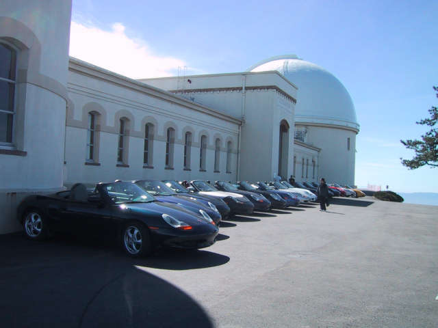
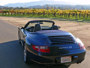
Facebook My Photos – Porsches In The Park – Gardnerville, Nevada: “http://www.facebook.com/album.php?aid=40524&l=fc694&id=730192740”
Monthly Archives: June 2008
World oil reserves quickly depleting?
Keeping up with the growing requirements for oil in 1st and emerging economies is straining every facet of the oil industry. Add to that, we are running out!
California new law approaching July 1st
 Not only is talking hands-free on your wireless phone a good idea for safe driving, starting July 1st, 2008 – if you’re 18 or older – California law requires it.* With this new law fast approaching, now’s the perfect time to pick up a hands-free accessory. Follow the law all the way to your local AT&T store today.
(California Vehicle Code Section 23123)
We know you love your mobile phone. You call your friends, family, and business associates from everywhere: at the store, at the beach, in the shower. Okay…maybe not the shower? Well, starting on July 1, 2008, if you talk on your phone while you’re driving, you’ll need to use a hands-free listening and speaking system. Drivers cited will be subject to a fine of $20 (at least $70 with fees and penalties) for a first offense and $50 (at least $175 with fees and penalties) for subsequent offenses. Push to talk (PTT) systems, such as those from Nextel, will be exempt from the hands-free edict until July 1, 2011.
California Driving Handbook & Auto Information
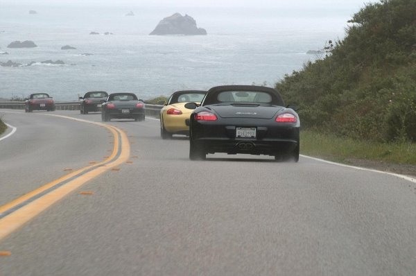
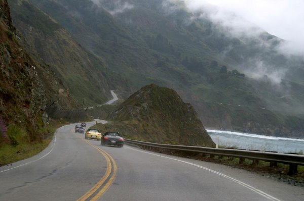
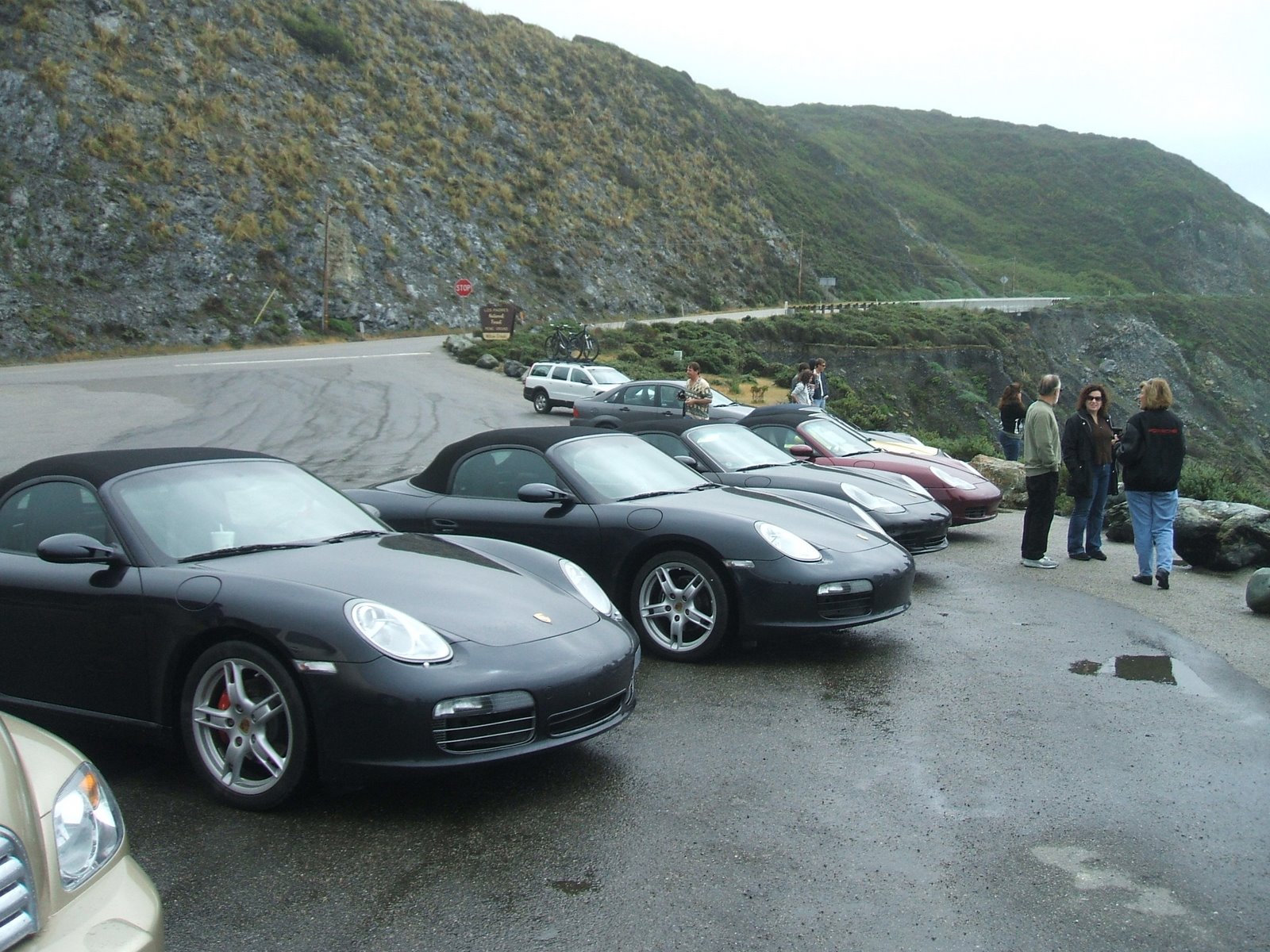
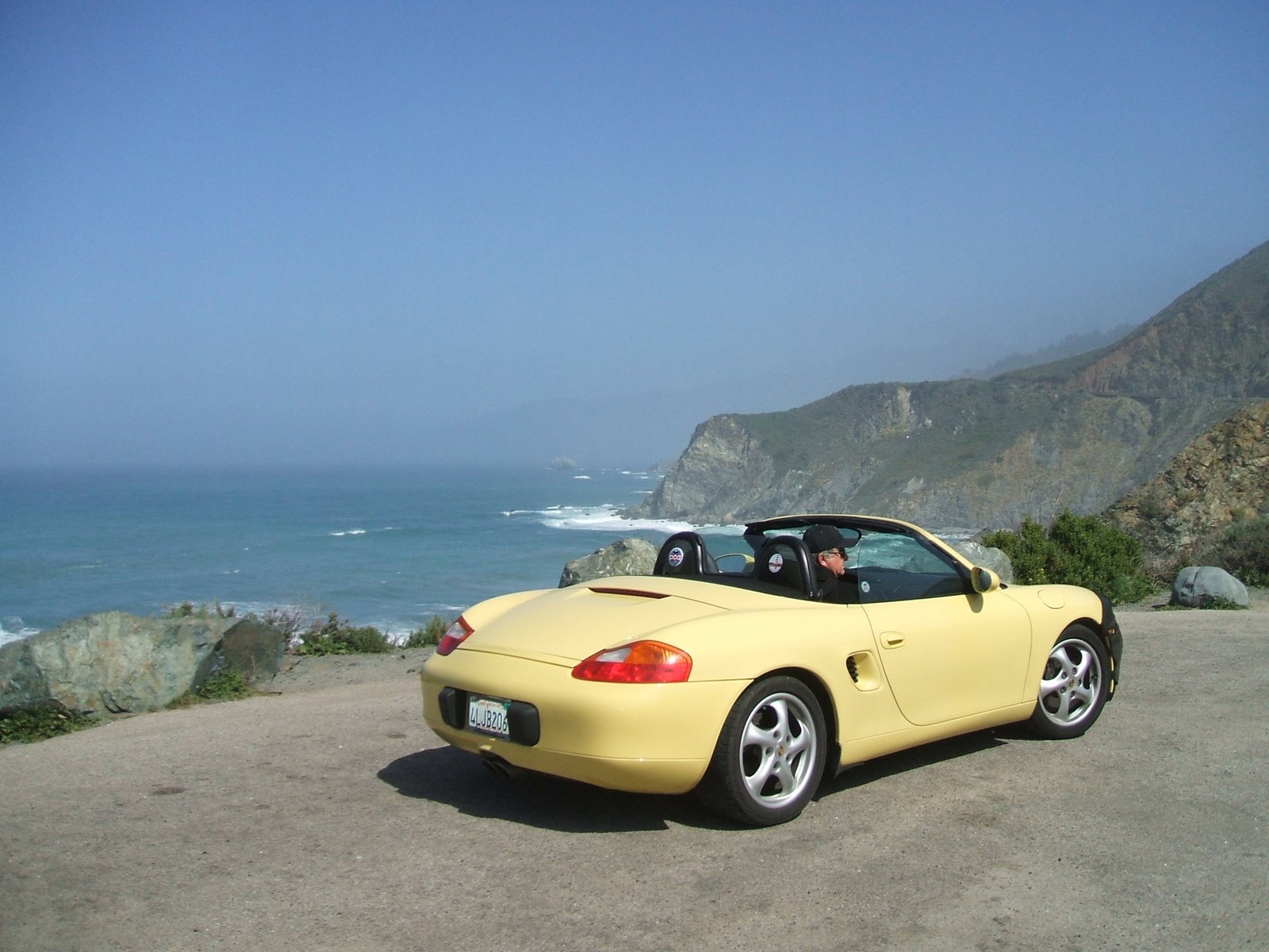
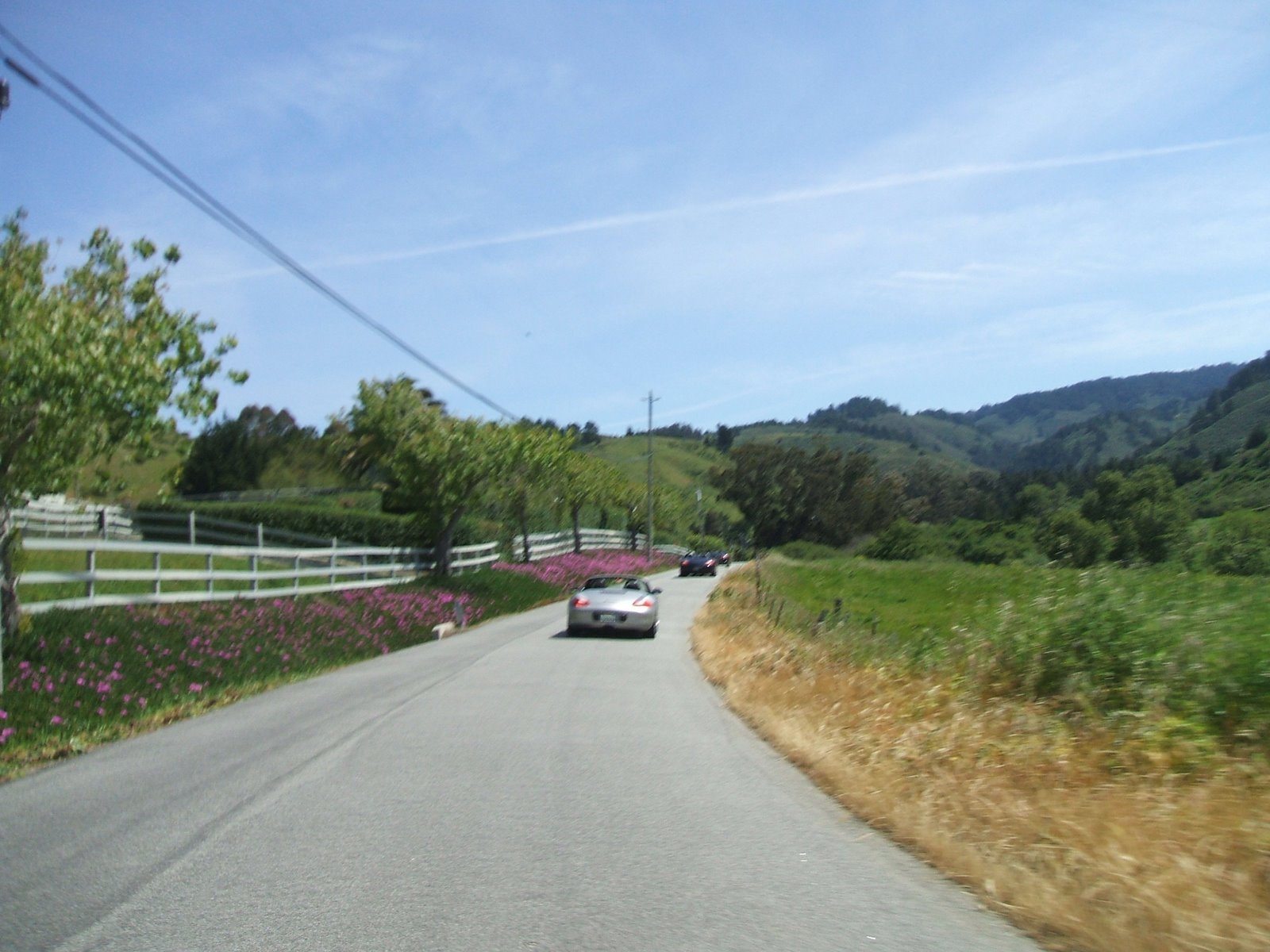
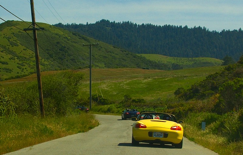
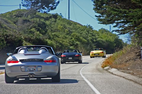
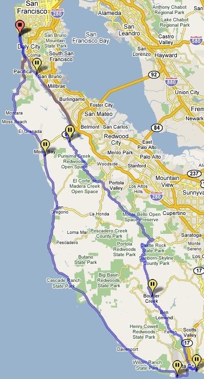
Pacific Coast Hwy 1 tour to Morro Bay
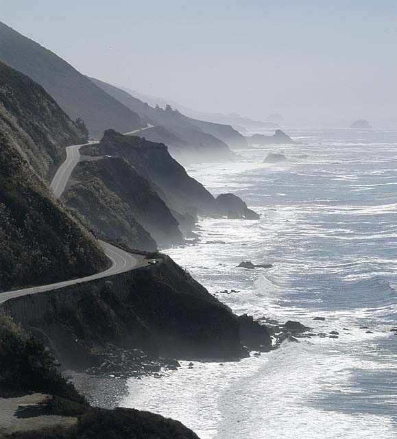
Big Sur, California”The Greatest Meeting of Land and Sea” Down Hwy 1 – now where are the Porsches?
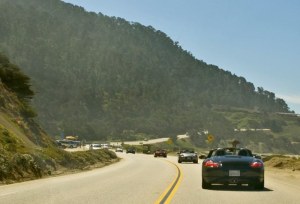
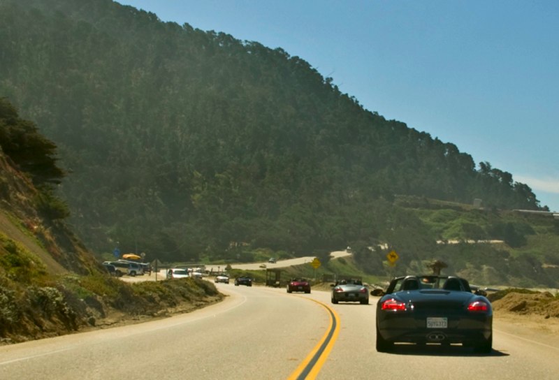
Tour details: Here are the details: meet in San Jose (off Hwy 101 & Hwy 85 – Bernal Road exit see below for more details)
and caravan down to Monterey/Carmel area and down Pacific Coast Hwy 1.
The directions to this route are pretty straight forward since it stays on one road, highway 1, the whole time.
The route is part of a stretch of Route One that was voted to be one of the “10 Best Drives” by the members of USAA insurance in 99 and made the list of 120 road trips highlighted in the Reader’s Digest book “The Most Scenic Drives In America” Along this route you will see coastal scenery that will leave you breathless. Opposite the ocean, inland scenery is as inspiring with its display of rolling hills, rock outcroppings, picturesque waterfalls, redwood forests, flowered meadows, lush valleys, and majestic coastal mountains. Along the route you will see a number of light houses, 18th century Spanish missions, and a variety of animal life including sea lions, sea otters, sharks, bat rays, gray whales, brown pelicans, and peregrine falcons as well as monarch butterfly winter sanctuaries.
Lunch stop @ Nepehente Restaurant in Big Sur! Or stop for picnic lunch at Mill Creek Park.

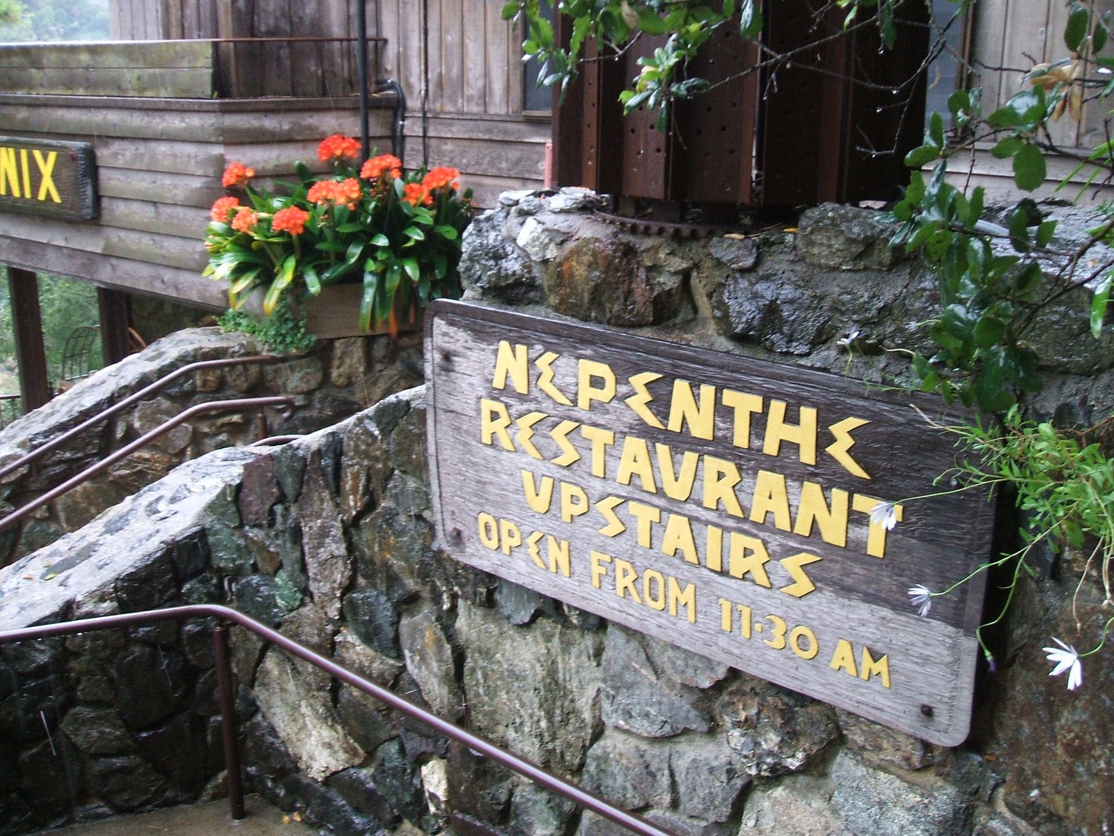
Perched 800ft above the Pacific on a rocky promontory, Nepenthe Restaurant has the second-best view on the Big Sur coast.
Nepenthe Restaurant, Big Sur, CA
Nepenthe’s website:http://www.nepenthebigsur.com/
WEATHER CAM: http://www.nepenthebigsur.com/images/weather-cam.html
WEATHER CAM: http://www.nepenthebigsur.com/images/weather-cam.html
See this Nepenthe Live Cam during daytime for great view:
click image for larger view
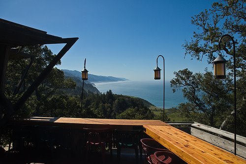
Check out today’s view South from Nepenthe’s back verandah
Nepenthe’s Verandah is like the prow of a ship. From this deck, visitors can enjoy a view of the early morning sunrise over the Santa Lucia Mountain Range, a relaxing afternoon, an intimate evening or a spectacular sunset over the Pacific Ocean. While there can be a wait for this small deck, it is always worth it.
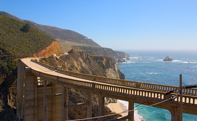
Cross the Bixby Bridge
You will also cross the much photographed Bixby Bridge (you’ve probably seen this bridge in a few movies, postcards or TV commercials). It arches 256 feet above the meeting of the Bixby Creek and Pacific ocean.
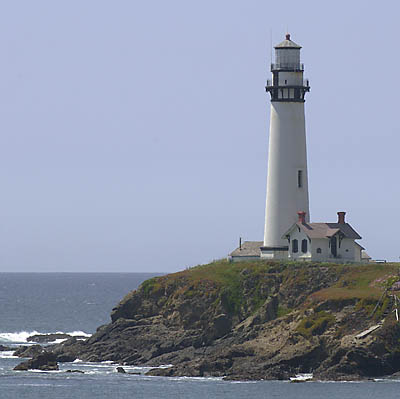
Just south of Bixby Bridge, the Point Sur Lighthouse stands atop a 360ft-high volcanic rock rising straight out of the surf. In continuous operation from 1899 to 1974, today it’s part of a state historic park that you can visit only by guided tour (reservations not accepted).
You will also cross the much photographed Bixby Bridge (you’ve probably seen this bridge in a few movies, postcards or TV commercials). It arches 256 feet above the meeting of the Bixby Creek and Pacific ocean.
Just south of Bixby Bridge, the Point Sur Lighthouse stands atop a 360ft-high volcanic rock rising straight out of the surf. In continuous operation from 1899 to 1974, today it’s part of a state historic park that you can visit only by guided tour (reservations not accepted).
Have a great drive down the coast! http://av.steppenwolf.com/mp3s/all_time_greatest_hits_lo/brntbwldl.mp3
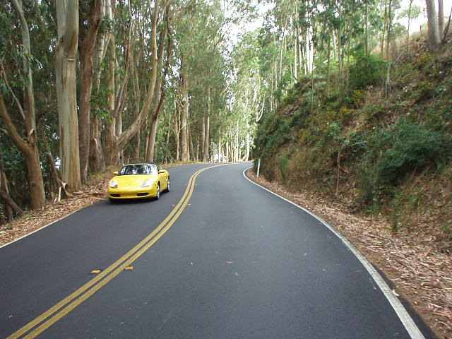
Coastal Overlooks
Run to the Coast
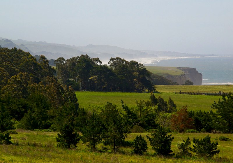
You can’t beat the San Mateo Coast
for verdant springtime splendor—and you can do it in an afternoon.
Rolling hills rise from the craggy coast,
covered with different species of grass
that create a patchwork of subtly different hues.

From San Francisco: 60 minutes to San Gregorio, via I-280 south to Hwy 1 south in Pacifica.
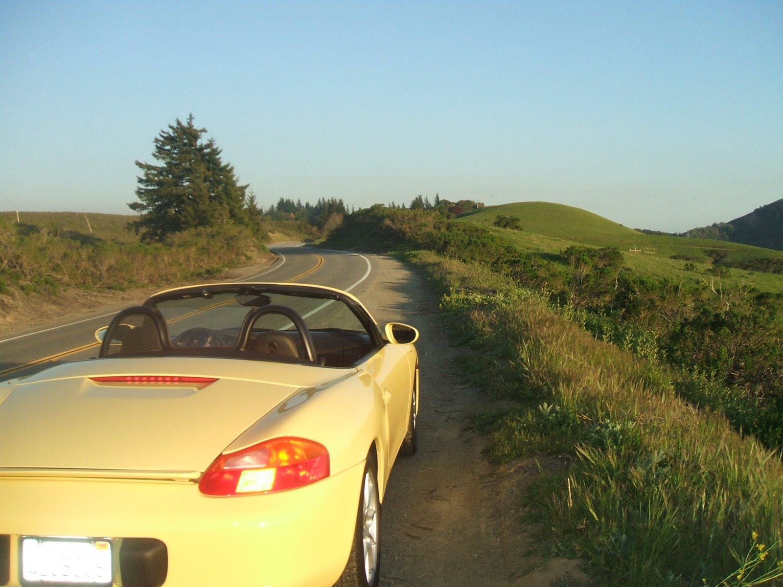
Chase the margin of green along the old stagecoach route,

from San Gregorio to Pescadero.
Then continue south along Cloverdale Rd,

past picturesque horse farms lined with white split-rail fences.
At Gazos Creek Rd, turn right to Hwy 1 north.
Travel time from SF: 60 minutes to San Gregorio,
via I-280 south to Hwy 1 south in Pacifica.

What to See: The Pigeon Point Lighthouse,
on your return trip north up Hwy 1.
Where to Pack a Picnic:
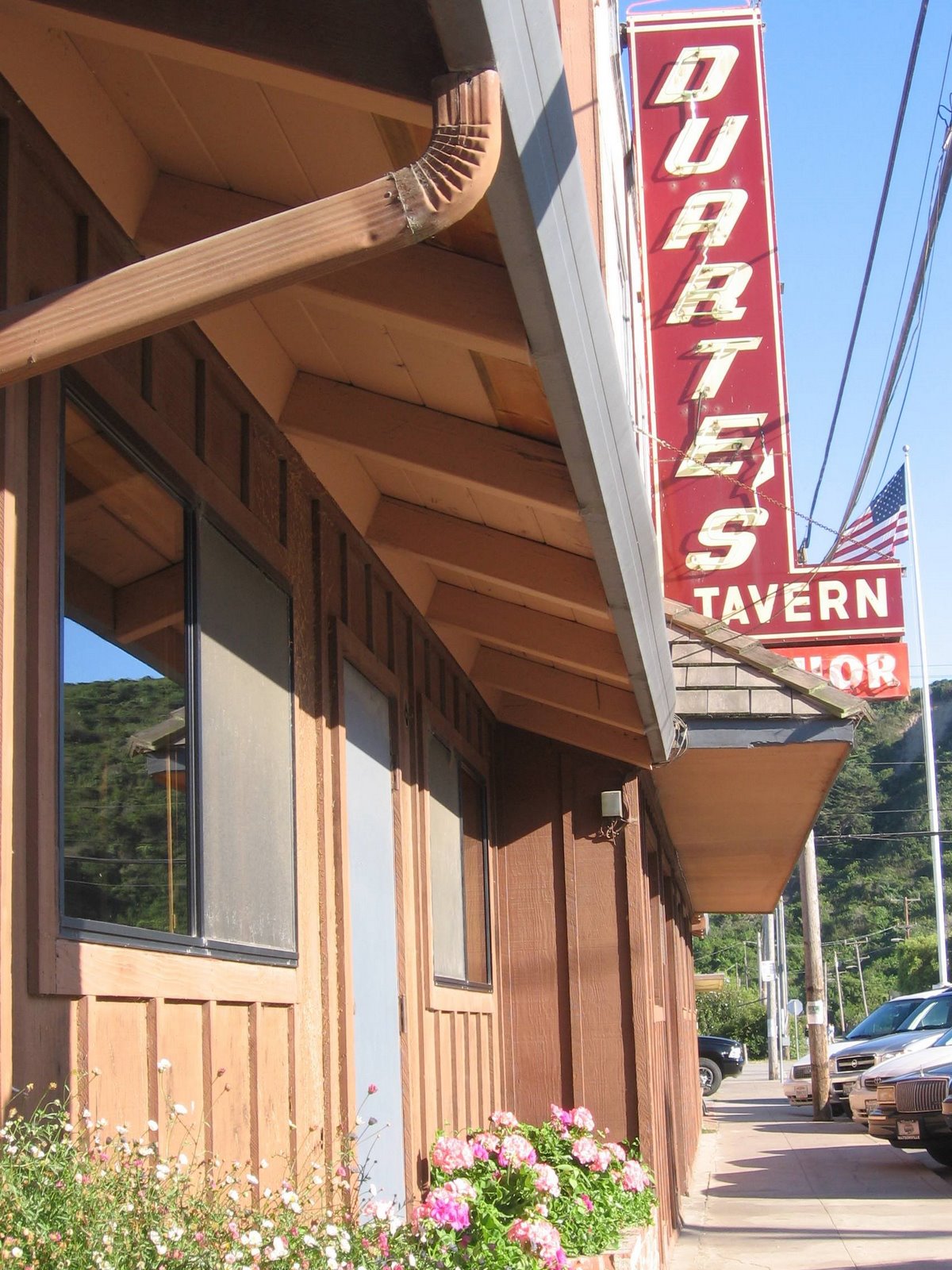
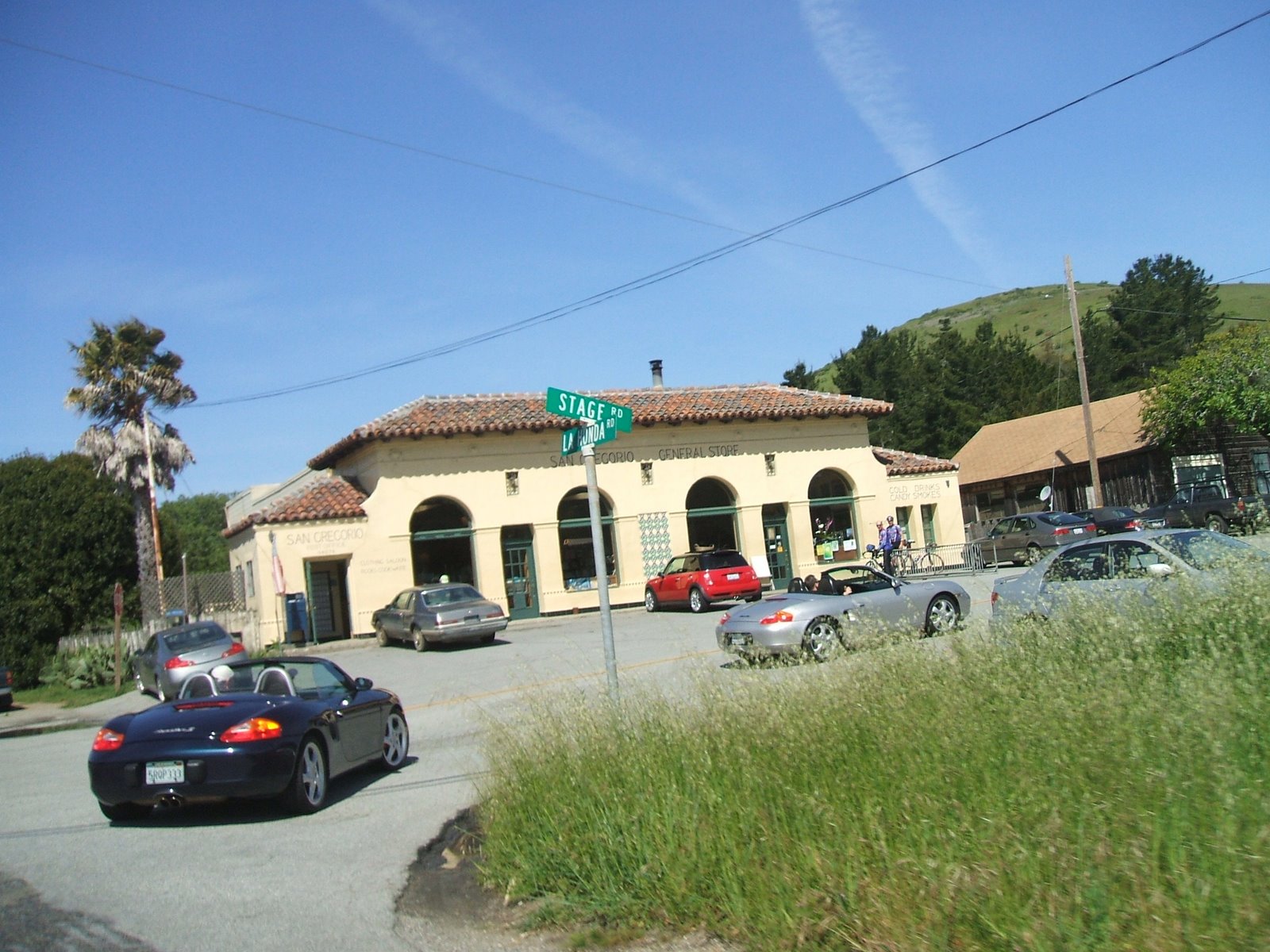
The San Gregorio Store, a
frozen-in-time 19th-century general store.
San Mateo Coast Beaches
The San Mateo coast beaches are some of Northern California’s most majestic. Come on a weekday and you’ll have the sand to yourself. Get there early—before 10am—to claim a grill at one of the picnic areas, or sleep late and bring your own self-contained Weber. The beaches are strung together like pearls on a strand, don’t assume all the county’s beaches are alike. Far from it. Each has its own flavor and amenities. Bean Hollow State Beach, is the only dog-friendly beach this side of Half Moon Bay. Here’s a rundown of favorites.
San Gregorio State Beach,
Pescadero State Beach,
Half Moon Bay State Beach,
Bean Hollow State Beach,
Año Nuevo State Reserve,
Pomponio State Beach,
When the beach is not in your plans, you can watch hang gliders take their lives into their own hands at Fort Funston on your start or return of your road trip.
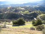
Patterson Via Mt. Hamilton
 Mt. Hamilton from Patterson
Another trip via Mt. Hamilton from Patterson. From Porsche Club of America
As you exit Interstate 5, go west and immediately turn right onto Del Puerto Canyon Road. Further west, the canyon narrows sharply, the curves tighten and second gear is often required. As the road climbs, the pavement is not in very good shape, but the quality improves once you reach the Santa Clara County line. At The Junction, you could turn right and go back to Livermore, 31 miles away, but it’s more fun to turn left onto San Antonio Valley Road towards San Jose.After a short rest, keep going west toward San Jose on Mount Hamilton Road. More tight and twisty stuff, all downhill. The road is quite narrow, and unfortunately the pavement is in fairly bad shape, so take it easy. It can get crowded on the weekends. Enjoy the view if you can, and practice heel and toeing on the down shifts.
Journey Through an East Bay Backroad – Top of Mt. Hamilton
Great California drive in the Spring, not in the Summer!
With the sky the brightest blue, fields popping out all over in electric greens, and the invigorating Spring charge to the air, the time is to get outside now. But Spring is never the time to go anywhere fast: This is the season of the journey, not the destination.
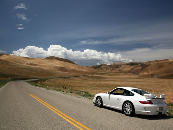
Loneliest Road Tour
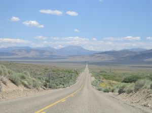 U.S. Highway 50 – Loneliest Road in America Tour
Notes of tour
by Porsche Club Of America
Lonely roads, especially if they are well-surfaced and lightly traveled, are perfect for touring Porsches. This fact is well known to PCA, who planned an excellent weekend trip to the furthest reaches of eastern Nevada, via the now-famous “Loneliest Road in America”, US 50.
"Hit The Trail " Tour by Porsche Club Of America
 “Hit The Trail” Tour- more information here
If you are having breakfast at the Country Inn before the tour, resist the urge to have that 8th cup of coffee unless you really can go a couple of hours between pit stops.


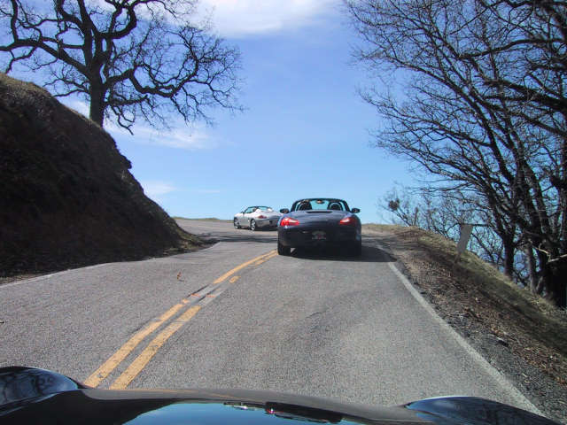
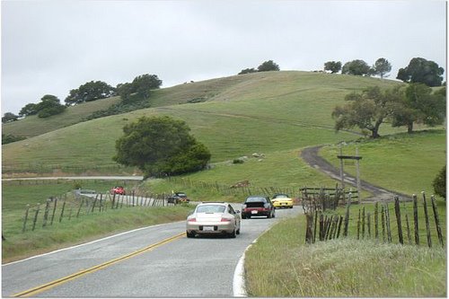
Carmel Valley Road and River Road Porsche Tour
 Carmel Valley Road and River Road Porsche Tour
Porsche road destination from Carmel Valley Road and River Road
Here is a recent backroad article from PCA-GGR past president.
Here is a recent backroad article from PCA-GGR past president.
Carmel is a very popular northern California destination year-round. Whether for golfing, shopping, sightseeing or simply hanging out, the area is a magnet for weekend travelers. Few folks explore the back roads in the vicinity, however, as most prefer to congregate on Highway 1. In this installment of Porsche Roads, I want to tell you about a very picturesque and less traveled alternative.
San Jose to Freedom Porsche Drive
 San Jose to Freedom Porsche Drive
Porsche road destination from San Jose to Freedom
Here is a recent backroad article from PCA-GGR past president.
Here is a recent backroad article from PCA-GGR past president.
In our on-going quest to stay off boring freeways and explore local back roads, this month’s installment of Porsche Roads takes us south from San Jose toward Monterey and the Pacific Ocean.
Directions and Map of Mendocino Area

From the Bay Area/San Francisco Route – For a spectacular coastal tour of Northern California north from San Francisco, take Highway 1 to Mendocino.
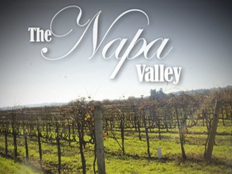
Wine Country Tour – Fall Road Rally
 Golden Gate bridge
 Highway 1 past Marshall and Tomales, which is great for sports car driving.
 Wine Country Tour – Fall Road Rally
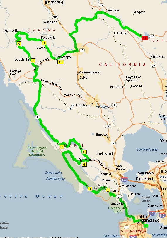
Wine Country Map Tour – North of San Francisco, Up Pacific Coast Highway 1, visit Stinson Beach or Tomales Bay for coffee, stop in Occidental for lunch,continue to Napa Valley for wine tasting or late dinner.
(1) Cross the Golden Gate Bridge and (2) follow the Pacific Coast Highway north to (3) Olema and head east to the (4) Nicasio Resevoir for a spirited drive through the redwoods. Rancho Nicasio- a great place to stop for a cold drink.
After the loop, you’ll continue north on the PCH and follow (5) Tomales Bay until you come to (6) Bodega Highway. The Bohemian Highway is one of Northern California’s best kept secrets when it opens up to some hidden vineyards and tree lined twisty backroads. Stop for lunch in (7) Occidental at the
and enjoy some fantastic Italian cuisine at their 130 year old establishment. After lunch, keep heading towards (8) Guerneville and along the (9) Russian River until you end up in (10) Santa Rosa. Porter Creek Road will take you through the mountains and into Calistoga where you can relax at one of dozens of hot springs and spas. Continue down the Silverado Trail until you find (11) Auberge Du Soleil
for a sunset patio dinner with breathtaking views of the valley below. Beautiful Wineries, Spas and Inns.

Great country backroads, lots of twisties, awesome scenery, excellent winery and great food at the end of the trail. You don’t want to miss this route and all it has to offer.